
ROSES GAP ROAD, OLD GOLDFIELDS ROUTE IN THE GRAMPIANS
- Traveldriven
- Oct 26, 2021
- 2 min read
Updated: Mar 28
Located within the Grampians National Park. Victoria.
Roses Gap Road is a fully sealed road connected to the Western Highway and Wartook. Provides access to Beehive Falls. These are usually just a trickle of water in the warmer months. Troopers Creek bush camp sites and The Wander Inn, Wartook are nearby by car. The more direct route to Halls Gap is a relatively flat gravel road of 20 km plus.
Bushfires have raged in the area as can be seen from a few roadside fire affected signs that were never replaced. The bushland generally recovers within one or two years of a fire burning through the area. In the summer months the national park can get high temperatures and in turn this will dry out the underlying scrub.
Roses Gap Road, once known as the 'Old Adelaide Road,' holds a significant historical value as it served as a vital route connecting different regions. This road, steeped in history, winds its way through picturesque landscapes, offering glimpses of towering cliffs that majestically rise from the surrounding bushland. The sight of these impressive cliffs, just a few kilometres off the road, adds a sense of grandeur and awe to the journey for travellers passing through. As one navigates along the current road, the presence of these natural formations serves as a reminder of the rugged beauty and geological wonders that characterise the area.
Traveldriven
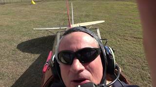
DRIVE HALLS GAP TO ROSES GAP ROAD

HEAT AFFECTED SIGN FROM BUSHFIRES

TRACK CLOSURE NOTICE

GRAMPIAN WILDFLOWERS

TOWERING CLIFFS ALONGSIDE
ROSES GAP ROAD


VIEW FROM TROOPERS CREEK
BUSH CAMPGROUND

TROOPERS CREEK AMENITIES CAMPGROUND

UNWIND AND RELAX WEEKENDS
THE WANDER INN.


Comments